
Bathymetric Lidar
What is bathymetric LiDAR?
Bathymetric lidar is a cutting-edge and highly efficient laser technology utilized for scanning below water levels, providing indispensable data for a diverse array of applications. By utilizing both green and red laser beams, this advanced technology can deliver high-quality scans from the shoreline, whether it’s an inland water source or the vast expanse of the sea. With its dual laser system, the bathymetric lidar is capable of scanning depths of up to 20 meters, providing essential information for underwater mapping and surveying. With its unparalleled accuracy and detail, this revolutionary technology is transforming the way we explore and comprehend our underwater world.
Bathymetric data from an airborne platform is revolutionizing the time it takes for this critical information.

How is bathy LiDAR collected?
Bathymetric lidar is typically collected at lower altitudes than traditional LiDAR. The optimal flying height, achieved using our fixed wing aircraft, is approximately 400-500m AGL. This approach means increased flying time for the overall coverage, but it also means a larger collection window in SE Asia. Moreover, airborne bathymetry systems enable collection times that are significantly faster compared to traditional vessel based systems. This translates into reduced project collection time and mobilization time, allowing for critical data to reach end users in a more timely manner.
Another advantage of bathymetric LiDAR systems is their superior data density in comparison to traditional Multibeam Echo Sounding (MBES). While MBES typically has a traditional return every 1-5 meters, bathymetric LiDAR enables sub-meter detail, with several points captured within a square meter pattern.
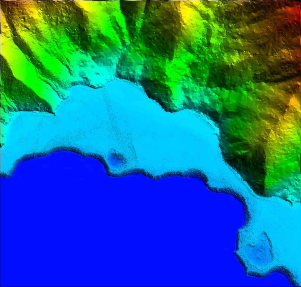
Bathymetric data quality is allowing users to visualize the ocean floor like removing the water from the area of interest.

Subsurface Laser Returns
LiDAR bathymetry is constantly innovating and improving data quality. The technology that PTMI employs, uses both a red and a green band laser. What this means is that we can collect data both inland and offshore in a single flight. The traditionally ellusive “grey zone” which is traditionally the 0m to -10m ASL band, is collected with ease and with detail and accuracy not realized by using the traditional vessel-based approach.
This single dataset also addresses the merger of both subsea and terrestrial data so that end users have contiguous data that can be confidently used for their project, whether that is port planning, barge terminals, breakwalls or whatever other nearshore uses the project may require.
Nearshore bathymetric LiDAR deliverable
Inland Waterways
Bathymetric LiDAR is a highly effective solution for gathering data and creating accurate visualizations of inland waterways. Thanks to this technology, canals, rivers, and lakes can be surveyed with ease and precision. Our team is always available to provide further information and answer any questions you may have about bathymetric LiDAR. Just contact us and we’ll be happy to assist you!
Inland waters collected at unprecidented speeds

Why bathymetric LiDAR from PTMI?
PTMI is proud to be the undisputed leader in cutting-edge LiDAR technology across Southeast Asia. Our state-of-the-art system not only allows us to collect dense terrestrial data but also enables us to cover critical “grey zone” areas in the water where standard multibeam echo sounding vessels cannot access.
Our team has extensive experience conducting aerial surveys of both inland waterways and coastal areas, including critical reef and shore slope. We understand how crucial accurate data can be to the success of a development project, and we are committed to delivering the highest level of professionalism in all our work.